Description
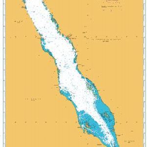
The ADMIRALTY Raster Chart Service (ARCS) provides raster chart coverage of international shipping routes, main ports and harbors in a comprehensive range of scales. Ideal for both bridge crews and shore based users, it combines the familiarity of traditional ADMIRALTY paper charts with the precision of satellite positioning to support decision making.
Key features of ARCS include:
-
Familiar, clear and easy-to-use digital charts, helping bridge crews to understand critical information at moments of peak workload and pressure
-
Extensive coverage of international routes and ports in a comprehensive range of scales
-
Weekly ADMIRALTY Notice to Mariner updates to support safe navigation
-
Compatible with a wide range of office based systems enabling cost-effective digital charting for shore-based users
Find out more about the features of ARCS >